
Coastal safety · Malta
Explore Malta’s coast with confidence.
Real-time sea conditions, bathing water quality, coastal hazards and local insights. Everything you need to plan better and explore safely.
Web app live now iOS and Android apps coming soon
- Live sea conditions
- Marine navigation
- Hazards and alerts

What Kosta checks
Safety information is the product. Routing is how it reaches you.
Every plan pulls the same picture together, so nothing that matters gets left off the screen.
Point-to-point routing
Set a start and a destination on the coast: a sheltered run along the Sliema front, or the exposed channel crossing from Ċirkewwa out to Comino. Kosta plans the sea passage between them so you know the distance and exposure before you commit.
Live wind & conditions
Current wind speed, direction and gusts along your route. This is the single factor that most often turns a calm plan into a hard day on the water.
Hazard warnings
Ranked alerts for offshore winds, swell and exposed stretches, shown prominently and colour-coded by severity. Warnings lead the read-out.
Official water quality
EEA-classified bathing-water status for Malta’s beaches, from Mellieħa and Golden Bay to Gozo, refreshed from weekly environmental-health testing rather than crowd-sourced guesses.
Vessel-aware advice
Kayak, swim, SUP, Jetski or small boat: the same conditions read differently. Kosta tailors the safety call to how you are actually travelling.
Coastal attractions
Beaches, bays, caves and swim spots from the Blue Lagoon to the quieter inlets around Gozo, with the local detail that tells you which ones are worth the crossing today.
Inside the app
What you actually see before you go
Warnings lead every screen. Everything else, the route, the conditions and the water quality, sits underneath as the reason for the call.
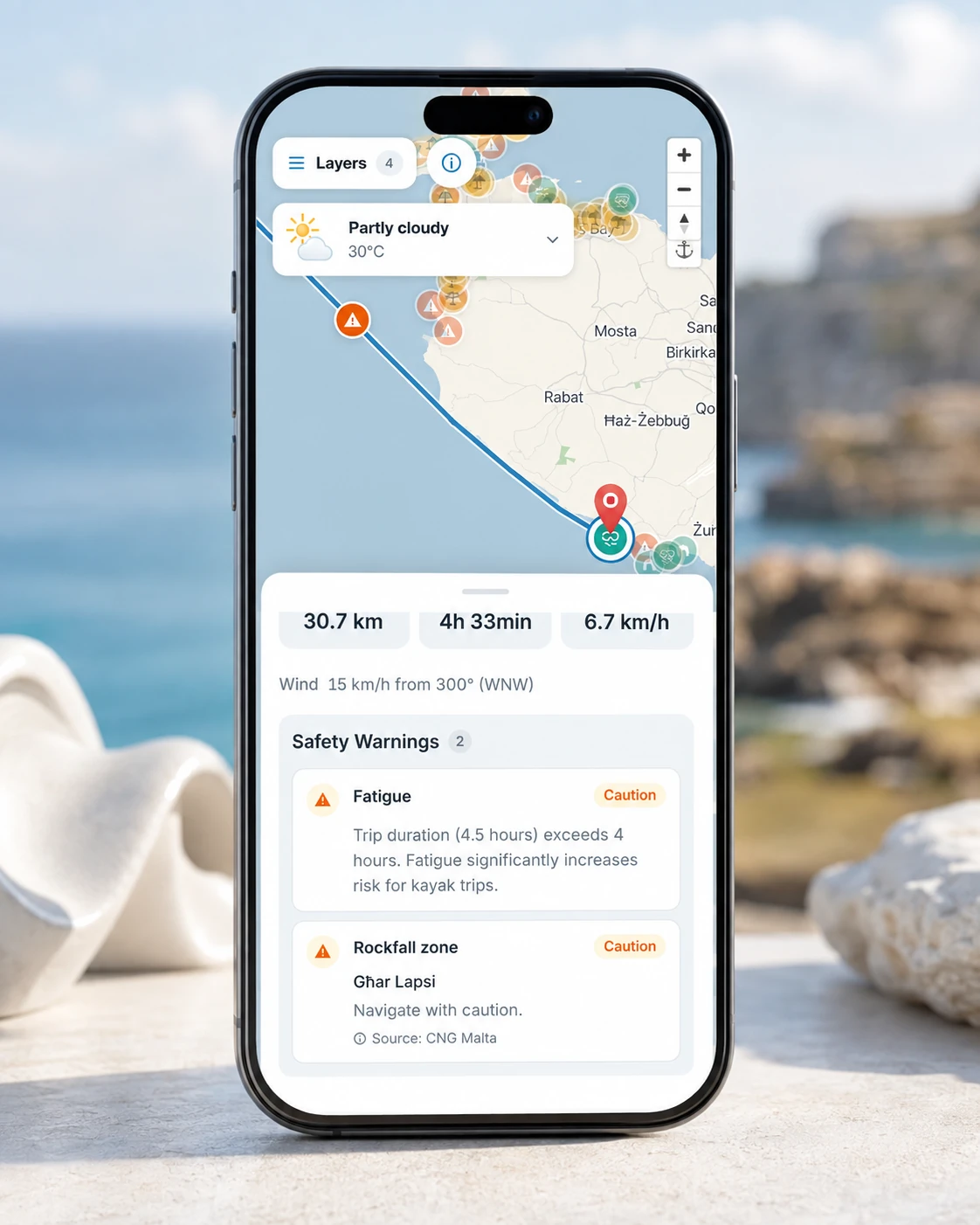
Ranked hazard warnings along the planned passage. 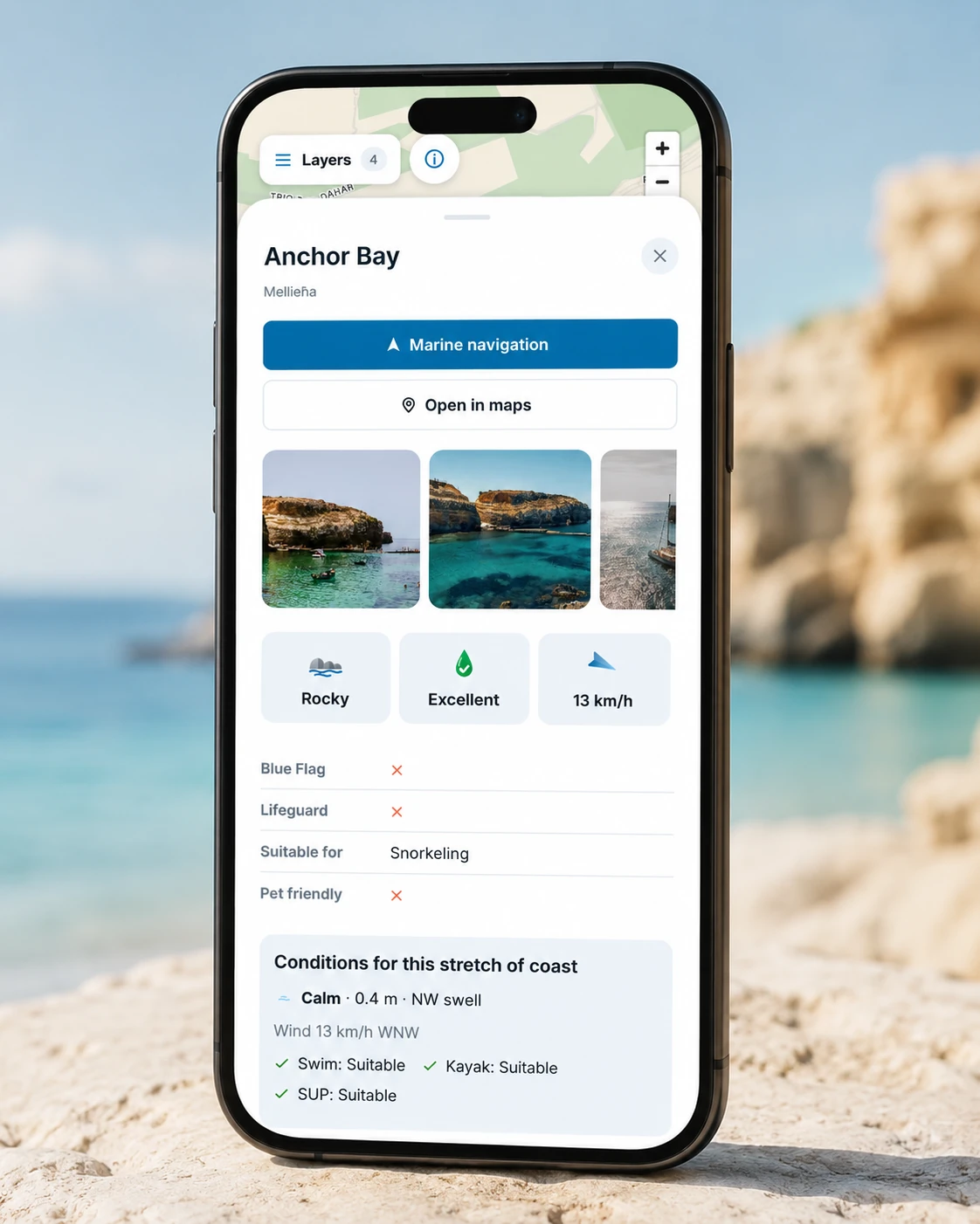
Official bathing-water status at your destination. 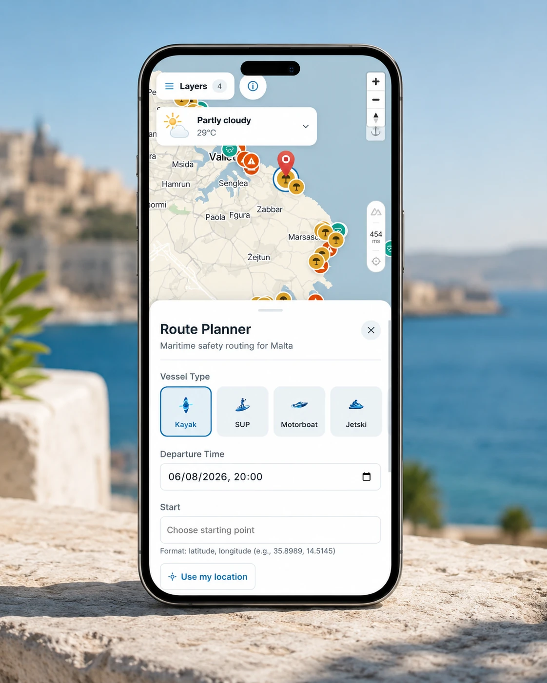
The same route, read for your vessel type.
Our data
Conservative by design, transparent by default
A safety read-out is only as trustworthy as what it’s built on. Kosta draws on official and open sources, names them plainly, and leans towards caution wherever the data is uncertain.
EDP bathing water results
Weekly water-quality sampling from Malta’s environmental-health monitoring, so status reflects the latest testing.
Open weather & maps
Wind, gusts and coastal geometry drawn from open meteorological and mapping sources, updated live.
CNG Malta hazard reports
Hazards reported around the island by CNG Malta. Obstructions, closures and local conditions that never show up in weather data.
Our tech
How the routing engine reaches a verdict
Kosta isn’t a weather widget with a map behind it. Every read-out is the output of a pipeline that turns official data into a navigable model of the sea, searches it for a passage, and scores that passage against how you’re travelling, resolving towards caution at every uncertain step.
- 01
Ingest & normalise
Official water-quality classifications, live meteorological readings and hazard reports arrive on their own schedules. Each one is normalised and reconciled onto a single coastal model, so every source describes the same stretch of sea the same way.
- 02
Build the sea graph
Malta’s coastline and the water around it are discretised into a navigable graph. Land, harbours under restriction and no-go zones are removed as nodes outright rather than made expensive, so a route can never be talked into crossing them.
- 03
Search for a route
A weighted shortest-path search runs over that graph. Edge cost blends distance with exposure: wind angle relative to travel, fetch, and how long you spend in open water. The returned passage is the safest reasonable one, not merely the shortest.
- 04
Weight by vessel
The same conditions read differently from a kayak, a swim, a SUP or a small boat. The vessel profile changes both the edge weights and the thresholds at which a condition becomes a warning, so advice shifts with how you are actually travelling.
- 05
Rank, then lead with the worst
Hazards found along each segment are ranked by severity and the most serious one leads the read-out. Where data is stale or uncertain, the scoring resolves towards caution, never away from it.
Common questions
Before you set out
Is Kosta free to use?
Yes. Kosta is free and needs no account. Open the map, set two points on the Maltese coast and the full safety read-out comes back — wind, hazards and official bathing-water quality.
Can I kayak across to Comino and the Blue Lagoon?
Only if you paddle open water already, and only on the right day. The crossing from Ċirkewwa is around 3.5 km, and that number is the trap: it is fully exposed the whole way, through a channel that funnels wind, runs current and carries the Gozo and Comino ferries. Experienced paddlers more often cross from Gozo, where the passage is shorter. Kosta plans whichever line you choose, scores each segment for your vessel and leads with the worst thing it finds, so a day the channel is not on is something you learn before you launch rather than halfway over.
Where does Malta’s bathing water quality data come from?
From official sources, not crowd-sourced reports. Classifications for Malta’s designated bathing waters follow the European Environment Agency, and results are refreshed from the weekly environmental-health sampling that covers beaches from Mellieħa and Golden Bay round to Gozo and Comino.
Which vessel types does Kosta support?
Kayak, swim, SUP, Jetski and small boat. The vessel you pick changes both the route weighting and the thresholds at which a condition becomes a warning, because the same wind reads very differently from a paddleboard than from a powered hull.
Does Kosta replace official maritime warnings?
No. Kosta is a planning aid. It does not replace official maritime warnings, local knowledge, or your own judgement on the day. Conditions at sea change quickly. Always check official sources before you set out, and turn back if anything looks wrong.